Current Observations
North Daniel Boone Country
 Winds are from the Southwest at 12.7 gusting to 21.9 MPH (11 gusting to 19 KT). The pressure is 1020.9 mb and the humidity is 56%.
Last Updated on Apr 28 2024, 11:54 am EDT.
Winds are from the Southwest at 12.7 gusting to 21.9 MPH (11 gusting to 19 KT). The pressure is 1020.9 mb and the humidity is 56%.
Last Updated on Apr 28 2024, 11:54 am EDT.
Central Daniel Boone Country
Winds are from the South at 13.8 gusting to 23.0 MPH (12 gusting to 20 KT). The pressure is 1022.3 mb and the humidity is 50%.
Last Updated on Apr 28 2024, 11:53 am EDT.
South Daniel Boone Country
Winds are from the South at 12.7 gusting to 19.6 MPH (11 gusting to 17 KT). The pressure is 1022.4 mb and the humidity is 52%.
Last Updated on Apr 28 2024, 11:56 am EDT.
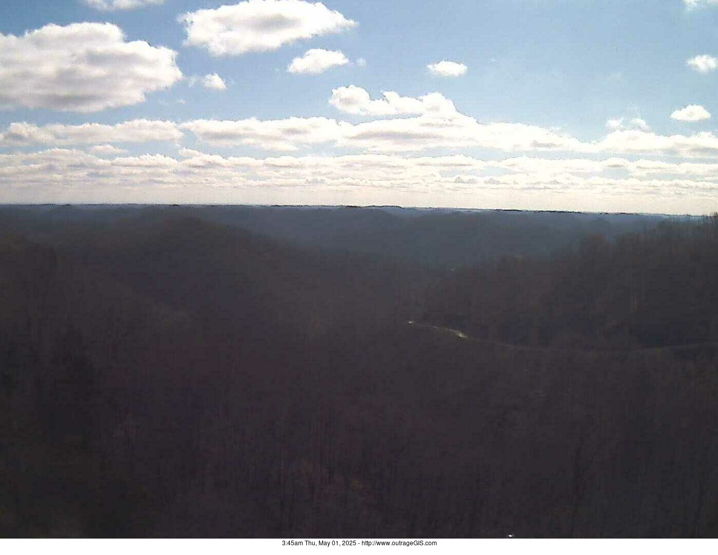
Current webcam: Enlarge
Why are the images dark? It's nightime Daniel Boone country! Photo is realtime webcam from the National Weather Service station in Jackson, Kentucky.
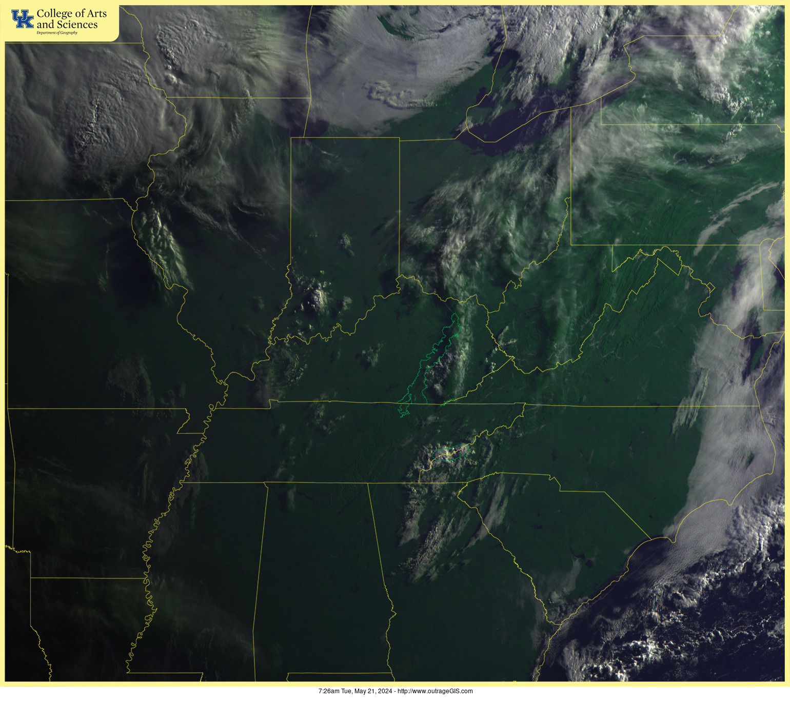
Daniel Boone Visible Satellite
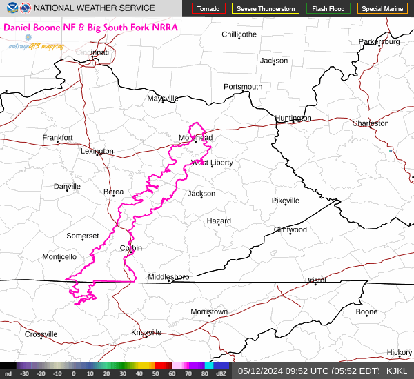
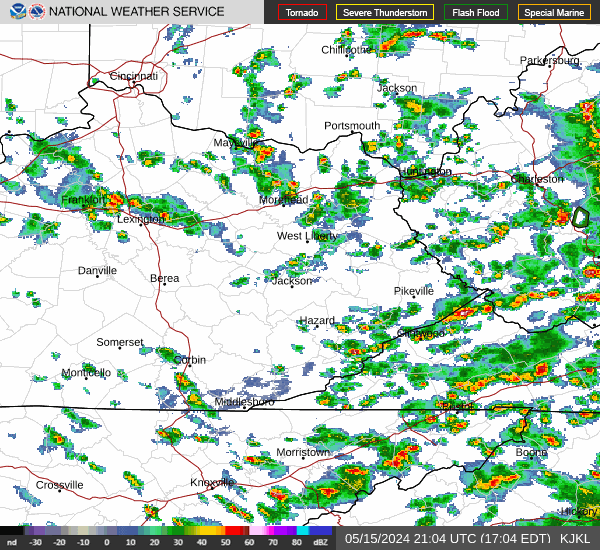
Daniel Boone Doppler Radar
Enlarge | Animate | Doppler Radar FAQ from NOAA

Current regional Radar: Enlarge | Animate
More about doppler radar images on NOAA's website. Broad circular areas of cyan & blue should not be interpreted as precipitation on this composite radar.
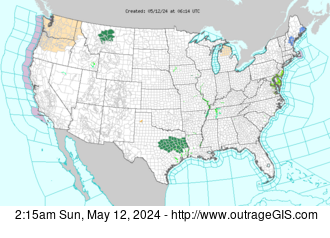
Current Watches & Warnings: Enlarge
Daniel Boone Weather on NOAA's website
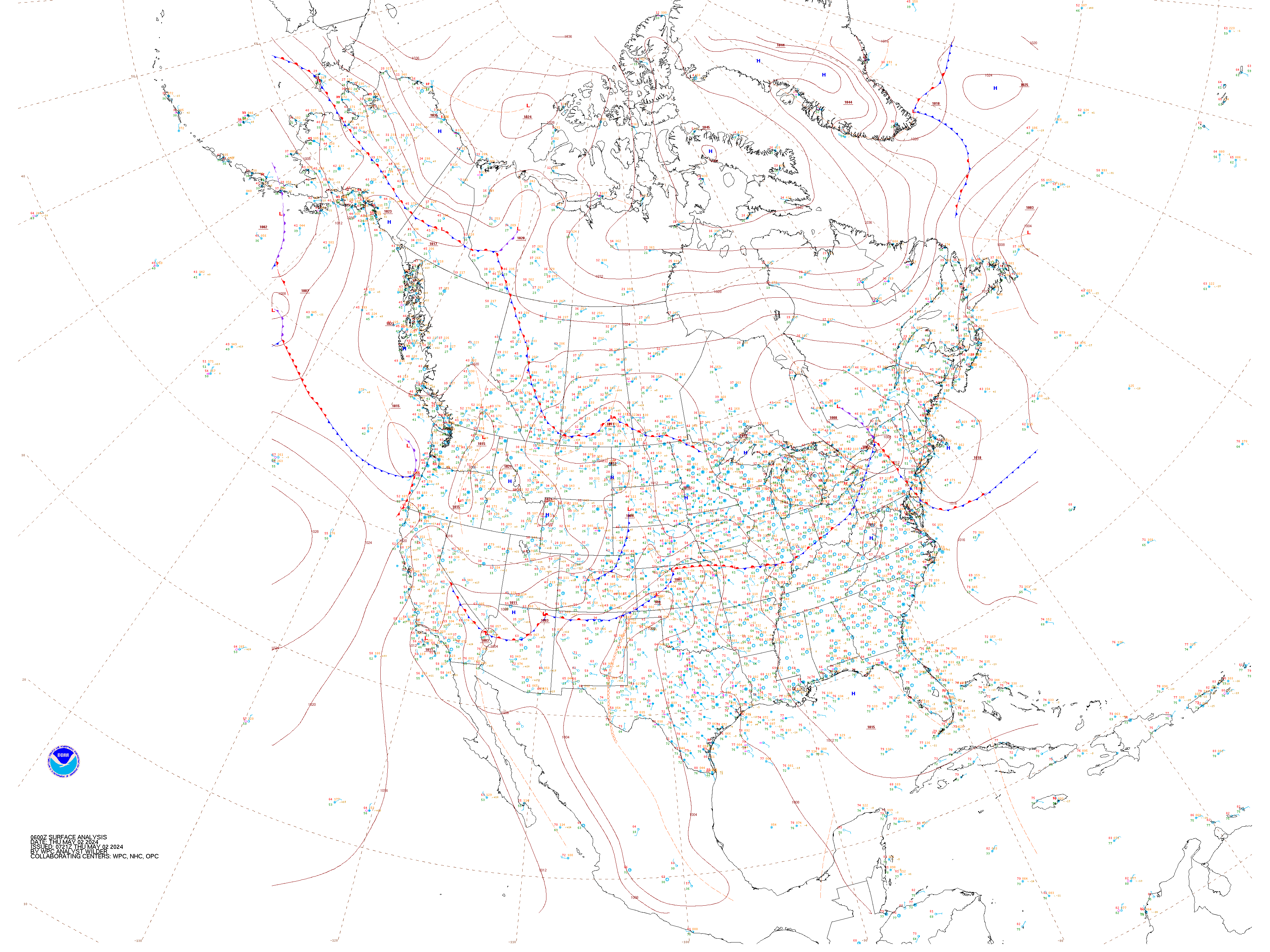
Current Surface Weather Observations: Enlarge
Print key for weather station data. Please note that this map gives station observations for only temperature, wind speed & direction, cloud cover, and weather condiitons.
Daniel Boone Country radar
Red River Gorge Forecast
| NWS Forecast for: 2 Miles ESE Slade KY Issued by: National Weather Service Jackson, KY Last Update: 9:47 pm EDT Apr 28, 2024 | |
| Tonight: Mostly clear, with a low around 56. South southwest wind 3 to 8 mph. Winds could gust as high as 17 mph. Monday: Sunny, with a high near 84. South southwest wind 11 to 13 mph, with gusts as high as 20 mph. Monday Night: A chance of showers and thunderstorms, then showers likely and possibly a thunderstorm after 5am. Increasing clouds, with a low around 61. South southwest wind 5 to 10 mph, with gusts as high as 15 mph. Chance of precipitation is 60%. New rainfall amounts between a tenth and quarter of an inch, except higher amounts possible in thunderstorms. Tuesday: Showers and possibly a thunderstorm, mainly before 3pm, then a chance of showers and thunderstorms after 3pm. High near 72. South wind around 7 mph. Chance of precipitation is 90%. New rainfall amounts between a half and three quarters of an inch possible. Tuesday Night: A 30 percent chance of showers and thunderstorms, mainly before 7pm. Partly cloudy, with a low around 56. Light southwest wind. Wednesday: Sunny, with a high near 81. Wednesday Night: Mostly clear, with a low around 57. Thursday: Sunny, with a high near 86. Thursday Night: Partly cloudy, with a low around 62. Friday: A chance of showers before 1pm, then a chance of showers and thunderstorms between 1pm and 5pm, then showers likely and possibly a thunderstorm after 5pm. Partly sunny, with a high near 81. Chance of precipitation is 60%. Friday Night: Showers and thunderstorms likely. Mostly cloudy, with a low around 61. Chance of precipitation is 60%. Saturday: A 50 percent chance of showers and thunderstorms. Mostly sunny, with a high near 77. Saturday Night: A 30 percent chance of showers and thunderstorms. Partly cloudy, with a low around 55. Sunday: A 30 percent chance of showers and thunderstorms. Mostly sunny, with a high near 78. | |
| 2 Miles ESE Slade KY 37.78°N 83.67°W (Elev. 997 ft) | |
Visit your local NWS office at: https://www.weather.gov/jkl |


Big South Fork Forecast
| NWS Forecast for: 6 Miles WNW Helenwood TN Issued by: National Weather Service Morristown, TN Last Update: 10:06 pm EDT Apr 28, 2024 | |
| Tonight: Clear, with a low around 57. Calm wind becoming south around 5 mph after midnight. Monday: Sunny, with a high near 83. South wind 10 to 15 mph, with gusts as high as 20 mph. Monday Night: A chance of showers and thunderstorms, then showers and possibly a thunderstorm after 2am. Low around 60. South wind around 10 mph. Chance of precipitation is 80%. New rainfall amounts between a quarter and half of an inch possible. Tuesday: Showers and possibly a thunderstorm before 2pm, then a chance of showers and thunderstorms after 2pm. High near 75. South wind around 10 mph. Chance of precipitation is 80%. Tuesday Night: A 30 percent chance of showers before 8pm. Partly cloudy, with a low around 55. West wind around 5 mph becoming calm in the evening. Wednesday: Sunny, with a high near 84. Calm wind becoming north around 5 mph in the afternoon. Wednesday Night: Mostly clear, with a low around 55. North wind around 5 mph becoming southeast after midnight. Thursday: Sunny, with a high near 88. Thursday Night: Partly cloudy, with a low around 61. Friday: A chance of showers and thunderstorms, then showers likely and possibly a thunderstorm after 2pm. Partly sunny, with a high near 80. Chance of precipitation is 60%. Friday Night: Showers and thunderstorms likely. Mostly cloudy, with a low around 60. Chance of precipitation is 60%. Saturday: A 50 percent chance of showers and thunderstorms. Partly sunny, with a high near 79. Saturday Night: A 30 percent chance of showers and thunderstorms. Partly cloudy, with a low around 54. Sunday: A 40 percent chance of showers and thunderstorms. Mostly sunny, with a high near 80. | |
| 6 Miles WNW Helenwood TN 36.46°N 84.67°W (Elev. 1030 ft) | |
Visit your local NWS office at: https://www.weather.gov/mrx |


Friendly Feeds
Our Recent Photographs & Maps


Our Favorite Hikes
 Cave Run Lake Trail Guide
Distance: 6 Miles round-trip from trailhead
Difficulty: ++
Scenic Views: +++
Elevation Relief: 500ft ^
Ownership: Daniel Boone NF, USFS
| Sheltowee Trace North Trail Map |
 |


Imagine the scene around Clear Creek Iron Furnace in the 1830’s, the trailhead for this hike...
Maps and Weather
We have a lot of great raster base map services available in Kentucky and I wanted to access them for my current location when I use my mobile device in the field. While there are many ways to make a mobile map, I wanted use Leaflet JS and build a custom geolocation service using the Geolocation ...
Our Clients' Maps

Click to open map
On September 20, 2014 a downtown Lexington neighborhood hosted a block party and potluck. Raffles were held, which indeed included some outrageGIS mapping hiking maps. This map is entirely custom and shows only sidewalks and the location of the block party. The map layers two di...
