One of the most obvious and striking winter weather conditions is the atmospheric influence of the Great Lakes. When high pressure builds to the west of the Great Lakes and there’s a prominent northwest-to-southeast surface wind flow, weather is significantly different downwind of the lake compared to upwind. This often produces lake effect snow that can truly bury southeastern shore cities. However, the same influence can reach far south into Kentucky and the Appalachians.
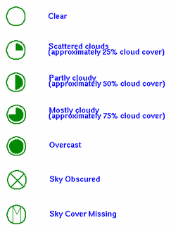
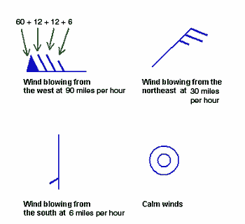
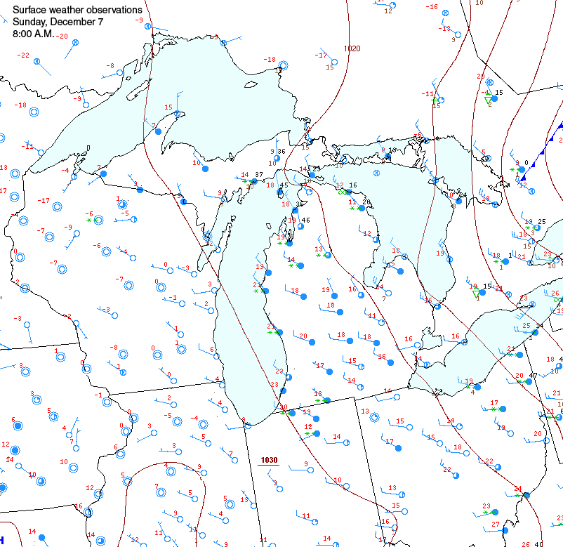
The difference in weather can be outstanding, as people who live near the lakes know very well. Observe weather on both sides of Lake Michigan. The red number indicates the temperature in °F and the circle indicates cloud cover. A solid circle is completely cloudy, and an empty circle represents clear skies. The barb indicates wind speed and direction (see below for legend).
Compare Lake Michigan’s west shore with its east shore. The west shore of Lake Michigan is cold, below zero, and cloudless. Weather on the east shore of Lake Michigan is 20°F warmer, it is cloudier, and snow is falling, as represented by the green asterisks.
The cause of these conditions is simply the great reservoir of heat that the lakes contain and transfer to the atmosphere through evaporation. Though the lakes are slowly cooling through winter, they are significantly above freezing across a large area. When a colder, dry air mass blows over the lakes, evaporation will transfer heat and moisture into the air mass. As the rising, warmer air cools, if often condenses resulting in cloudiness and heavy snow; the lake effect snow machine. Also note the how far south the warmer air has penetrated compared to other locations at the same latitude.


For example this station here:  is reporting that the current temperature is 55 degrees F, the sky is clear, and the winds are blowing from the north at 18 miles per hour.
And this station  is reporting completely overcast conditons, winds from the north at 24 miles per hour and the temperature is 58 degrees F.


