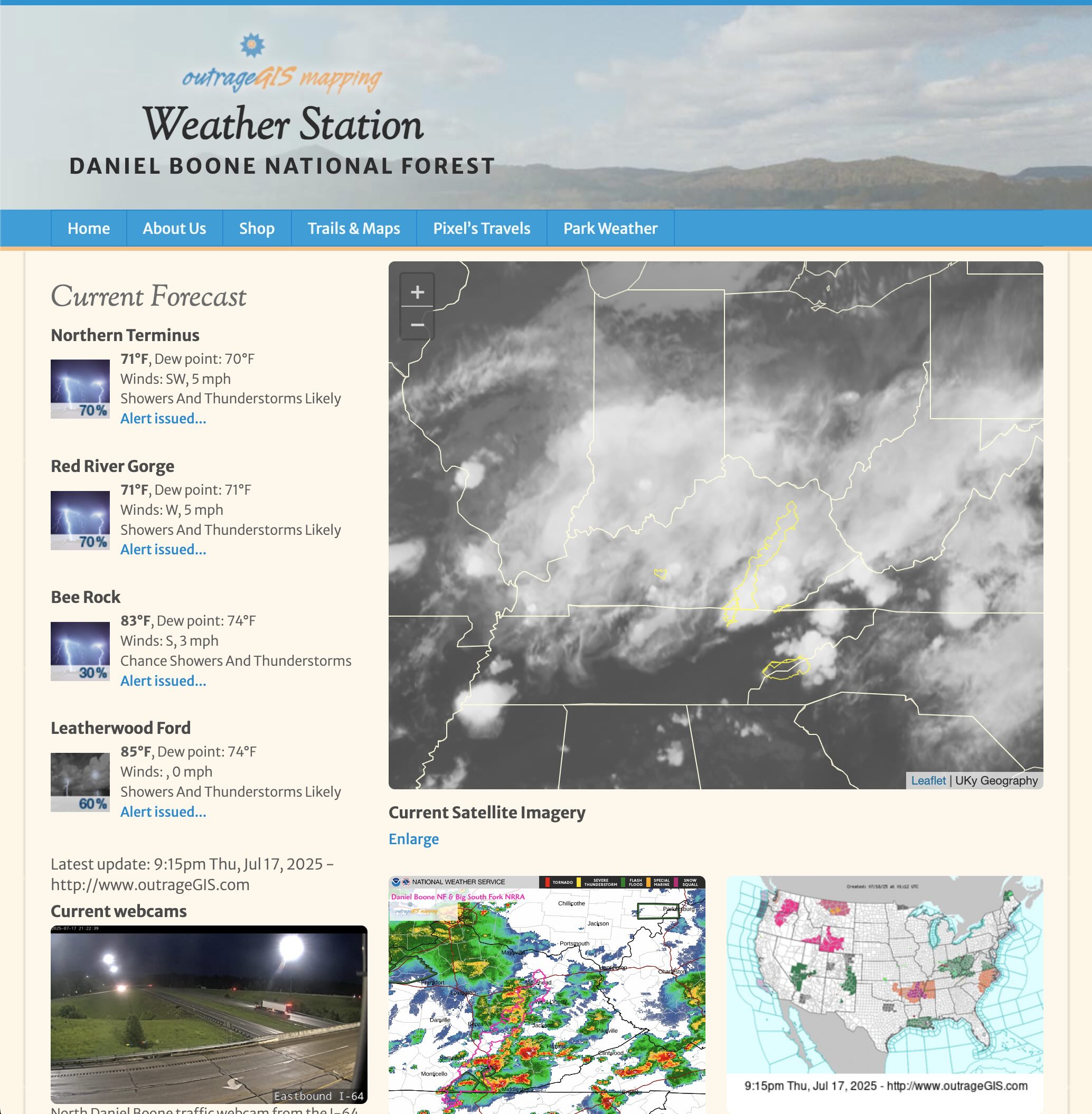
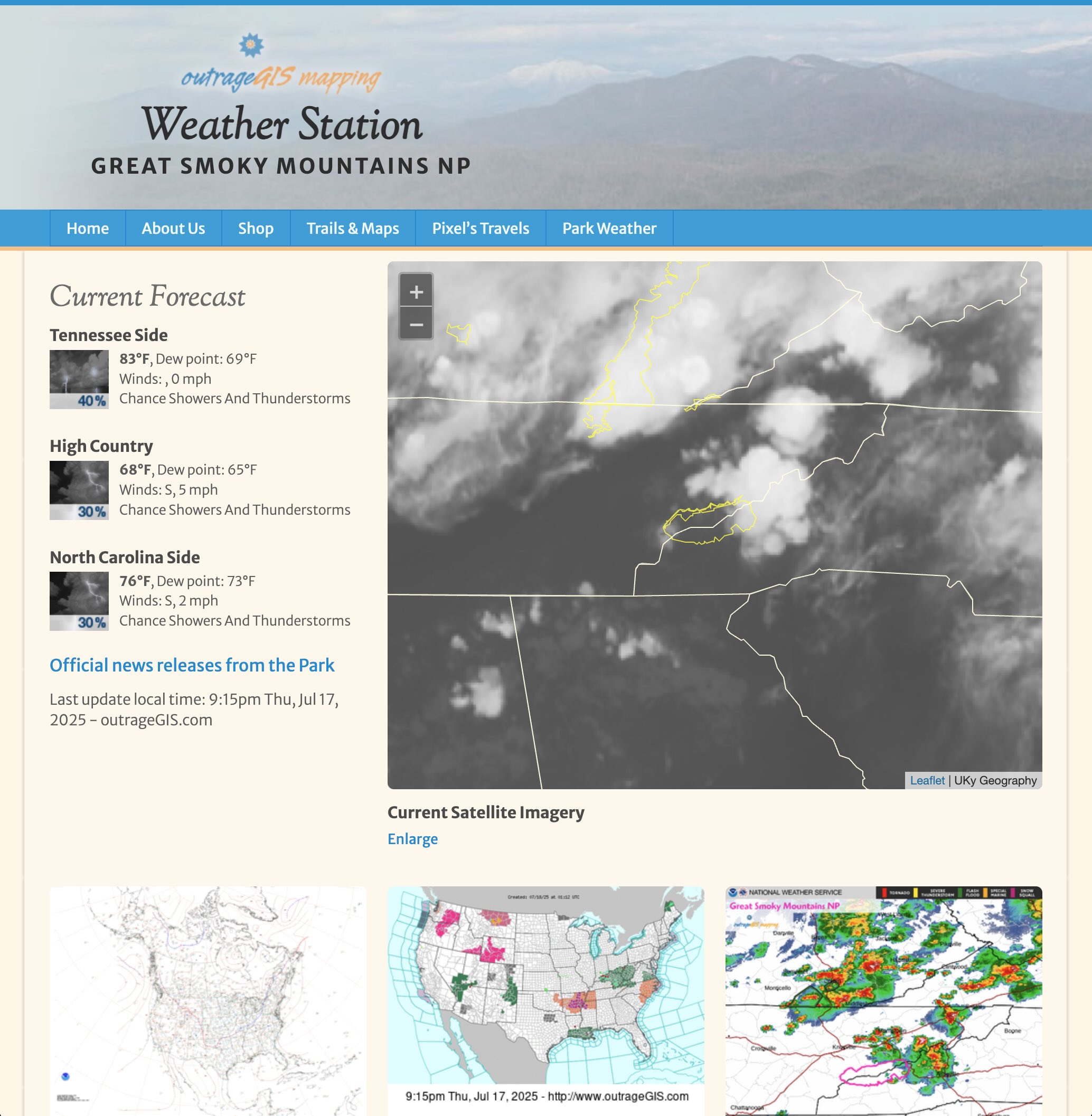
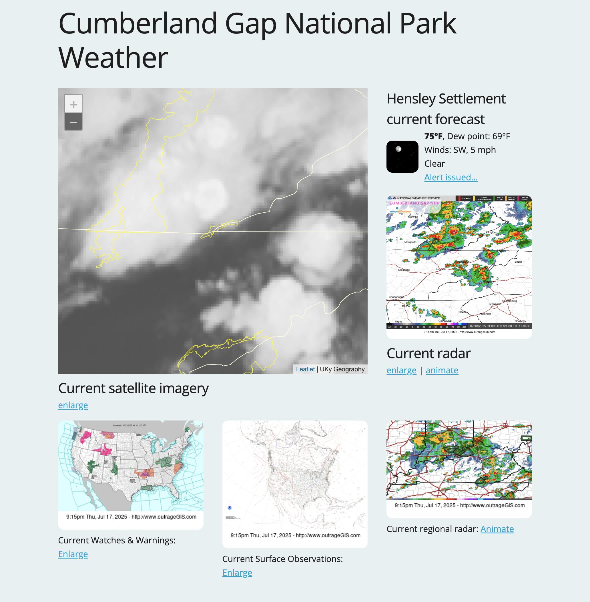
Great Smoky Mountains NP Weather
Current webcam from Look Rock, Tennessee.
Current webcam from Mammoth Cave NP, Kentucky.
Current view of our parks and forests

Enlarge (900 KB) | Two-hour time-lapse (10 MB) | Yesterday's time-lapse (100 MB) | BW animation
Weather in the Woods
We aggregate data from the National Weather Service, National Park Service, Weather Underground, and friendly twitter and blog feeds to help hikers understand weather and road conditions for the Daniel Boone National Forest and Great Smoky Mountains National Park.
Recent Photographs & Maps

Our Favorite Hikes

Natural Bridge profile from point cloud
This summer we are planning an update to our popular Red River Gorge trail map. Since the release of the Lidar point cloud data for Daniel Boone National Forest, we have been excited to start the project. With a pixel resolution of 5-foot, this is the most ...
Maps and Weather

Over Christmas break, it was time to automate collecting and displaying the incredibly detailed imagery from the GOES-16 Advanced Baseline Imager. A problem that plagued previous efforts was not accessing the raw data, a netCDF formatted file for the...
Our Clients' Maps
Working on the 2020 update of the Sheltowee Trace maps using high-resolution DEMs derived from lidar point clouds. An elevation profile was created by sampling elevation every 264 feet along the 343-mile trail. This profile shows the proposed extension from Burnt Mill bridge to Rugby.
