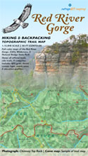
 Red River Gorge Backpacking Map
Distance: 3.4 Miles loop trail
Difficulty: ++
Scenic Views: ++++
Elevation Relief: 400ft ^
Ownership: Daniel Boone National Forest, USFS
| Red River Gorge Backpacking Map: $14 |  |
This well-used and maintained trail is the first (or last) segment of the challenging 10-mile Power Loop Hike. Starting at Gray’s Arch trailhead parking (map) walk a short quarter-mile double-width foot trail to an intersection with the Martin’s Fork Trail. Continue to the right passing the small field on Butterfly Hill. About a mile into the hike, you’ll find a few ridge top campsites west of the trail. An unmapped trail follows a narrow ridge above Left Flank climbing area.
![]() The arch and west rockhouse offer some of the biggest views under canopy in Red River Gorge. You can easily scramble around the boulders to find a compelling photograph. Since the arch is close to the trailhead and has great scenic attraction, you’ll probably enjoy the company of fellow hikers and photographers.
The arch and west rockhouse offer some of the biggest views under canopy in Red River Gorge. You can easily scramble around the boulders to find a compelling photograph. Since the arch is close to the trailhead and has great scenic attraction, you’ll probably enjoy the company of fellow hikers and photographers.
![]() Camping considerations: This is a fee area. Visitors leaving cars overnight will need to purchase a pass at local businesses and outdoor shops. Camping in rockshelters is prohibited forestwide. You can camp away from the arch, rockshelters, streams, and trails. You will need to observe the USFS backcountry camping rules.
Camping considerations: This is a fee area. Visitors leaving cars overnight will need to purchase a pass at local businesses and outdoor shops. Camping in rockshelters is prohibited forestwide. You can camp away from the arch, rockshelters, streams, and trails. You will need to observe the USFS backcountry camping rules.


