![]()
 Big South Fork Map
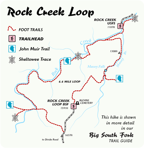
Distance: 6.6 Miles round-trip
Difficulty: ++
Scenic Views: +++
Elevation Relief: 520ft ^
Ownership: Big South Fork, NPS
| Big South Fork Trail Map: $12 |  |
Hike the scenic crossroads of the John Muir Trail and Sheltowee Trace. Rock Creek Loop is a 6.6-mile loop in our Big South Fork Guide. Half of this loop follows the cool waters of Rock Creek, a trout stream with small stretches of swift water and deep pools for summer refreshment.
Hikers weave through a forest dominated by old, stately Hemlock and American Beech trees with grassy, wildflower areas along the stream bank. The trail is a rugged footpath with a bridge across Massey Branch. Numerous backcountry campsites along the loop offer great weekend backpacking options with side trail options into Pickett State Park and the Daniel Boone National Forest.


Leave a Reply