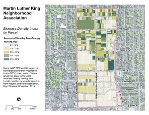
 A map showing ratio of property parcels covered in healthy canopy in the Martin Luther King Neighborhood Association in Lexington, Kentucky.
Using National Agriculture Imagery Program (NAIP) 2012 aerial imagery, a Normalized Difference Vegetation Index (NDVI) was created. Values greater or equal to 0.3 were assumed healthy canopy and (mostly) verified by visual inspection from imagery and summer field observations.


Leave a Reply