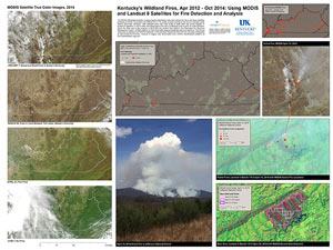
 Kentucky has damaging wildland fires, while also using prescribed burns to manage habitat. An unfortunate statistic tells us that most wildland fires in Kentucky are from arson.
This student lab uses MODIS Active Fire Detection products and Landsat 8 near-infrared bands to locate and analyze the largest fires between April 2012 and October 2014. IÂ hope to get point locations of smaller fires from Kentucky Division of Forestry to compare with satellite-based observations.


Leave a Reply