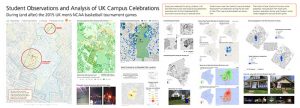
During two weekends this spring, students in UK GEO 309 (Introduction to GIS) were asked to log celebrations associated with UK men’s basketball NCAA tournament around campus in selected zones. Student teams were then tasked to map and analyze these patterns of celebrations during the last week of class. Their maps and photographs are shown here.
Their topics include: locations of campus rental properties, noise pollution from major party locations, population density, and changes in social media engagement during and after games.Â


Leave a Reply