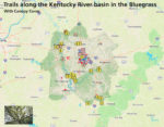
We’re excited to start compiling great hikes near Lexington and along the Kentucky River. Often we feel compelled to travel long distances to find natural areas to enjoy. While the Daniel Boone and Big South Fork forests provide multiday excursions, we can find challenging explorations along the Kentucky River and shared use paths in the Bluegrass. We also wanted to focus on opportunities to enjoy our tree canopy since most of our surrounding countryside is dedicated to private pasture and farmland.
Our goal is to do good research and offer a free map here to use on your mobile device. We will focus on five types of trails.
- Rugged and remote trails along the Kentucky River where on can explore the unique ecosystem of the Palisades.
- Shared-use trails that connect different parts of a city and provide opportunities to explore the urban edges.
- Walking trails, which are typically paved, that families can use to exercise and take a break from street sidewalks.
- Bike trails in the area, which are typically mountain bike and technical, but try to suggest trails that young cyclists can use for off-road fun.
- Canoeing opportunities on our public streams.
Enlarge map: https://outrageGIS.com/maps/bluegrass
You can follow our explorations on Pixel’s Travels. Here is 360 photo of the John Holder Public Trail in the Lower Howard’s Creek Nature Preserve.


Hello GSI Folks, I would add another bullet to the above list:
5. Paddling routes. Ky is full of boating trails.
Hey, Jeff! That’s a good suggestion and I’ve added it to the list and have reserved an icon on the map, which is now live. I’ll have to rely folks letting me know about these boat trails, since I’ve only floated a couple over the years.