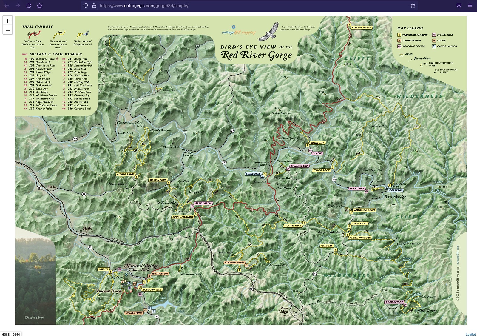
Over the past spring, we’ve been revamping our popular map for the Red River Gorge. The map should be available in early June. One of the additions is a new Bird’s Eye View map that user lidar elevation data and Blender 3d modeling software. You can view a zoomable image with this link


Leave a Reply