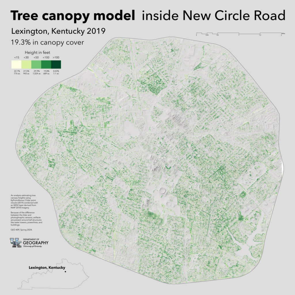
An analysis estimating tree canopy heights using KyFromAbove lidar point clouds (2019) combined with an NDVI layer derived from NAIP 2018 imagery for Lexington, Kentucky 2019. 19.3% in canopy cover.
Interactive map for existing canopy and for trees removed between 2010 and 2019.
Because of the difference between the lidar and photographic sensors, artifacts are present around tall structures like water towers, powerlines, and buildings.
GEO 409, Spring 2024.


Speak Your Mind
You must be logged in to post a comment.