New Bike Lex Map

BikeLex2013

Online map for shared-use trails and bike lanes

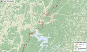
A new Bike Lexington map was released in June 2013. We developed a Tilemill online map version and it is online here. I have two directions we would like to go with this map. One, I’d like to establish legibility at all zoom levels so it can work on mobile devices. Two, I want to develop a version where users can submit reports on important or problematic locations with a focus on safety. It would be obvious to first map accidents and fatalities to communicate and understand how they happen.

We welcome any recommendations or contributions.

Hello TileMill: looking at Sheltowee Trace mileage

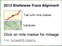
Landuse and trail with mile markers

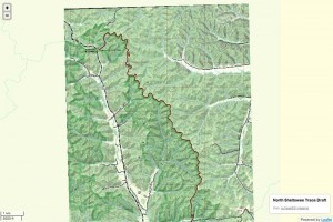
Sheltowee Trace trail with mile markers and landuse background image. First draft.

As we update the Sheltowee Trace maps, I took a diversion and looked at Tilemill from the folks at MapBox to create an interactive online map of the new alignment. Tilemill is pretty awesome app and allows you create a projects using a variety of spatial data, including Shapefiles, GeoTIFFs and GeoJSON (a new format to me, but shows some interesting possibilities).

map legendThe strength of Tilemill centers on few features; you can style layers in markup very similar to CSS, attribute data can be used for styling and interactively shown on the published map, attributes and features can be displayed differently at different zoom levels, and you publish to an MBtile file, a SQlite database. This format contains many thousands, no millions, of raster tiles that are served quite fast in your browser. In my opinion, a ton of creativity can be found in this free app.

For the Sheltowee Trace map, I pulled in a GeoTIFF of landuse with elevation hillshading, the ST trail with mile markers, and polygons of county and larger towns. After tinkering with the style sheets, I made a fairly simple map. I wanted to add so many more layers, but I had to see how it looked online. The simplest way to publish it to use MapBox’s service, but the .mbtiles file was 300 MB and I wanted to host on SheltoweeTrace.com. I needed to to use a few javascript libraries to serve this map on our server. I chose Leaflet through MapBox’s Wax library (inspired by this post) and it was fairly easy to setup. One thing I learned after a little frustration, the newest version of Leaflet.js will not work with the .js files in Wax. Use only the files included in Wax and it will work perfectly. The only other bit of code needed is something to read the data in the mbtiles file and format it properly for Wax. I used tileserver.php and it is important link if you want to display attribute data interactively.

While the map is very simple, it has some potential I think. Obviously the base map needs finishing with a good legend, but some exciting options include adding popup photos of significant trail features (with the future hope make this an interactive submission for users) and using Leaflet’s geolocation feature for mobile devices (pretty buggy now and there’s issue of offlining the data for use in the field).

Artwork & Copy submission for your Ad

Please provide contact information for your designer, if needed. We can build your ad from content you provide. We can also directly place your designed ad, if it does not exceed the ad’s dimension.

If you attach any artwork or document, please make sure it is no larger than 8mb and it is in the following format: .jpeg (JPEG photographic image), .png (graphics format), .ai (Adobe Illustrator), .pdf (Acrobat PDF), .doc (Microsoft Word) or .zip (a compressed file that could contain many files).

After you submit your artwork, we will give you a draft to edit or accept for publishing. You will also see and confirm the ad before the ad is printed.

outrageGIS mapping Ad artwork submission. Please provide contact information, in case we have a problem with your artwork.

**************************

* indicates required field

Acceptable file types: doc,pdf,txt,gif,jpg,jpeg,png,ai,zip.
Maximum file size: 8mb.

**************************

Late May in the Mountains

May 24 weather animation for Cold Mountain

Cold Mountain clears into view after the morning fog burns off and reveals the marvelous green from this spring’s abundant moisture. One can see that spring is just reaching the summit and a beautiful sunset occurred on this spring day.

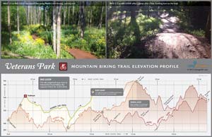
2013 Veterans Park Mountain Biking Trail Map

4.8-mile loop trail & out and back all on singletrack.

In tribute to Bike Lexington month, we’ve made a new map for beginning mountain bikers. If you’re new to trail riding and want tight, banking turns on fast, easy trail, then visit’s Lexington’s Veteran’s Park.

We created this map as a demonstration of small-area map making. We first walked the trail with a Trimble GPS unit this past winter to accurately locate the trail. We then used Kentucky’s new aerial photography and LiDAR elevation data to make 5-foot contours and heads-up digitized canopy coverage. We also pulled in the impervious and waterbody layers from the new Open Data Portal from LFUCG. This is all GIS data that has been created and/or made available in the past six months.

More nerd alert. The recent availability of small-scale mapping data is awesome. We thought we’d try to see how good this data is and make trail elevation profiles, which is included with this map. While the elevation profile is not perfect at this scale (with perhaps a +/- 8 ft height error for any given point on the profile), it gives a good distance measurement and represents well the relative slope of the trail. Since the vertical scale is not the same as the horizontal scale, the profile exaggerates the pumps & humps a rider faces…which means, the slopes are exaggerated.

Enjoy and tell us what you think.

Spring Day

April 15 weather animation

A nice cloud swept sunrise this past Monday and a fantastic afternoon to follow. Special days ahead.

UK Campus Native Tree Tour

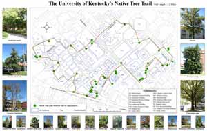
The University of Kentucky’s Native Tree Trail

The University of Kentucky Native Tree Trail

The great document was made by Forestry students in UK’s College of Agriculture in 2007 and we just found it! This 2.2-mile tour locates 45 native tree species on UK’s campus and includes pictures. From the description, the document appears to be a class project for FOR 599: Geographic Information Systems in Natural Resources. Now this is a great example of using classwork & technology to keep us green and appreciate our diverse flora.

By: Lee Moser and Matt Strong
Course Instructor: Dr. Songlin Fei

This project is supported by the UK Service-Learning Grant Program, Department of Forestry, and College of Agriculture.

Download and for other local tours, visit the Department of Forestry website and click on the left-hand link, “Links and Opportunities.”

Climate prediction for next weekend

6-10 day temperature prediction

6-10 day temperature prediction

We know this weekend is setting up to be the best hiking weather we’ve had in this year. So go out if you can! But if you can’t and would like to plan a trip next weekend, it’s also looking good. This climate model predicts we’ll have higher than normal temperatures and precipitation during next weekend and into the first of week following. Temperatures could average around 55° F with rain about 0.4″ above normal rates for April 10-14. That’s a good spring forecast and we welcome the coming of the growing season.

6-10 day precipitation forecast

6-10 day precipitation forecast

Tale of Two Years

We have a late spring this year and you can see it with the Look Rock webcam. The first image is from April 1, 2013 and doesn’t show much greening of the trees. The second image is an animation from April 1, 2012 and you can quickly notice much more tender green.

[Read more…]

Early Spring Snow in the Great Smokies

Snow on Mt. LeConte

In winters past, the highlands of the Great Smokies could expect an average of 8-10 feet of snow. This winter we’ve had much less, though the average temperatures have about normal. On March 26, however, we saw a dramatic snowfall with Mt. LeConte getting about 20″ in one storm with little snowfall at lower elevations. These images clearly show the snow line and give a unique feeling to the mountain scenery.

[Read more…]

Web page update

As we update the site for our 2013 hiking season, please don’t mind our fuss, too much. We’re trying organize our site better and offer more maps for spring.

Panama Adventure Hiking Elevation Profiles

Elevation profiles for adventure hiking.

Elevation profiles for adventure hiking.

Looking for a spring adventure? We designed a website and these elevation profiles for a client that creates custom tour packages for Boca Chica, Panama. Below are descriptions of a few tours one could enjoy before the rainy season.

Amistad Adventure Trek
Hike a truly unique and extreme jungle trail from the cloud forests to the Caribbean lowlands in this united National Park of Panama and Costa Rica. A 42-kilometer trek with 2,500 meters terrain relief that you hike in 3 days.

Comarca Adventure Trek
Explore remote forested regions and Caribbean slopes of the Panama cordillera. A 46-kilometer trek with 1,300 meters terrain relief that you hike in 4 days. The trail is filled with amazing views, steep climbs and descents as you traverse the footpaths of the Ngabe Indian Reservation.

When you need a new adventure, ExploreBocaChica.com

Carter Caves Trail Map

Carter Caves State Resort Park Trail Map. 1:16500 scale with Tygarts State Forest. Click to download PDF.

This topographic map shows official trails in the Carter Caves State Resort Park and neighboring Tygarts State Forest. The map contains detailed trail descriptions and an inset map for the trails around the campground and lodge. A one-color free version of the map is available at the park visitors center. A full-color map is available for purchase or download a digital copy here.

Rephotographing Lexington’s Streetscapes

Rephotographing Lexington’s Streetscapes. Click to view Google Map.

A collaborative final project for GEO 172, Introduction to Human Geography, Fall 2012, BCTCS

The class was tasked with rephotographing the streetscapes of downtown Lexington captured by Asa Coleman Chin in 1920-1921. Sanborn maps of the areas Chin photographed are provided as a reference.

Students then researched Lexington newspapers for information about city life during the period 1907-1921. Historic themes of urban improvement, segregation, and riots emerge. Students’ photographs & research show monumental change in areas of civic life, but often little change in many areas of the city’s built environment.

Sources: Kentuckiana Digital Library & Lexington Public Library

We won an award!

We submitted the Bike Lex Map for the Kentucky Association of Mapping Professionals 2012 Kentucky GIS Conference map competition. We competed and won 2nd place! It was a great conference in Louisville and I must say that I probably gained a few pounds from all of the great food.

0

Your Cart