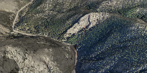
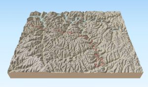
We’ve made a series of 3D views for Wolverine Publishing’s climbing guidebook for Boulder Canyon, Colorado. This image shows Eagle Rock and was made with high-resolution aerial photography and LiDAR elevation data. The data was supplied by Boulder Canyon Climber Community.
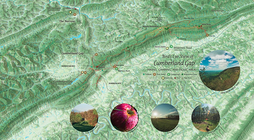
Cumberland Gap NHP interactive map
A bird’s eye view map of Cumberland Gap National Historical Park created in conjunction with our 2016 new release of the park map. This map is not georeferenced to real-world coordinates and uses a javascript mapping library, Leaflet, to generate the interactivity. We think of the developing project as a gateway for multimedia about the park’s environment and history that we want to share.
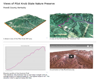
Pilot Knob State Nature Preserve student mapping project
Students in NRE 355 (a GIS calass at the University of Kentucky Natural Resources and Environmental Sciences program) visited the 740-acre Pilot Knob State Nature Preserve on September 21, 2016, and used mobile devices to collect GPS data for the existing trail network. They mapped approximately 3.2 miles of trail then used ArcGIS and CARTO to measure the trails and create a 2D map and 3D visualizations of the nature preserve. Students then created websites to showcase their work.
http://sweb.uky.edu/~blshea1/nre355/pksnp contains maps, animations, and links to student pages.
Cranksgiving 2017 map
This map is for Cranksgiving 2017, bicycle competition and food raiser for God’s Pantry Food Bank. I put it online this year since the race had about 5x as many grocery stores. Check out the printed manifest and the mobile map: https://outragegis.com/cranksgiving [Read more…]
Chicken Chase map
Downtown Lexington has a large number of chicken coops. A coop tour has been an annual event for years. In 2016 Floyd’s Farm & Home asked us to make a map of a tour centered on 6th Street. We used the artwork created by Homegrown Press (whose studio is located at 6th and Limestone) and tried to style the map in a similar fashion.
Elevation profile of connected interior spaces
It’s downtown Lexington, summer, and hot. Poor air quality and oppressive heat are hazards for older walkers and those with cranky babies. An interior (mostly air conditioned) pedway exists that connects various buildings downtown and is a walking convenience for many folks. When Lexington has more shady pedestrian paths away from city streets, walking inside wouldn’t be so inviting and necessary. [Read more…]
Cumberland Gap trail map at Woodland Art Fair, August 20-21
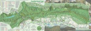
The update to our Cumberland Gap National Historical Park is almost complete. Much like the old map, our 2016 version is a 1 inch to 1/2 mile scale map with 50-foot contours, trail elevation profiles, and  GPS-mapped trails shown in vivid full-color printing. This year we added a layer that shows density of canopy coverage and GPS-mapped Caldwell Gap Trail. The size of the park has increased since our last update, so we’ve included most of the additional land. [Read more…]
Audio driving tour on SoundCloud
We’ve added our audio driving tour for Cumberland Gap and Pine Mountain to SoundCloud. This self-guided tour will show you over ancient buffalo traces and Native American trails that frontier settlers cut into roads seeking the fertile lands of Kentucky. You will walk through Cumberland Gap where the Wilderness Road and the Warrior’s Path meet and look out upon America’s First Frontier. Along the Kingdom Come Scenic Parkway, you will hear the rushing headwaters of the mighty Cumberland River.
Download audio and maps:Â http://www.firstfrontier.org/tour/FirstFrontier-Audio196kbps.zip
East End Preservation Project map
Base map for Salt Lake City hiking
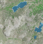
A client needed a base map for an upcoming hiking guide to areas east of Salt Lake City. We came up with a simple, clean photoshop file using NAIP aerial imagery and 1/3 arc-second seamless DEM. The NAIP was used to create an NDVI and estimated canopy cover and the DEM was used as a shaded relief and to generate 40 ft contours. The NDVI and shaded relief were used for emphasis and helped make the aerial ‘pop’ a little more. Lakes and perennial streams were added, but as you can see the don’t register perfectly with the aerial image.
Norris Watershed Trail Map
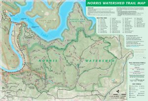
Over the past year, we’ve refined a trail map for the City of Norris, Tennessee. The Norris Watershed Trail Map is probably printed by now and offers GPS mapped trails and mountain biking opportunities. The WPA era dam is pretty cool, too.
City of Rocks and 3D mapping offer teaching moment
With the quality of elevation data increasing, especially with the availability of LiDAR data, we have an opportunity to make unique visuals. Recently Wolverine Publishing needed maps developed for the climbing area, City of Rocks in Idaho. The project needed high-resolution maps and the data was available through public sources. We like making the physiographic base maps for recreation areas and this offered a special challenge. [Read more…]
Lexington Bike/Ped versus Car Collision Analysis
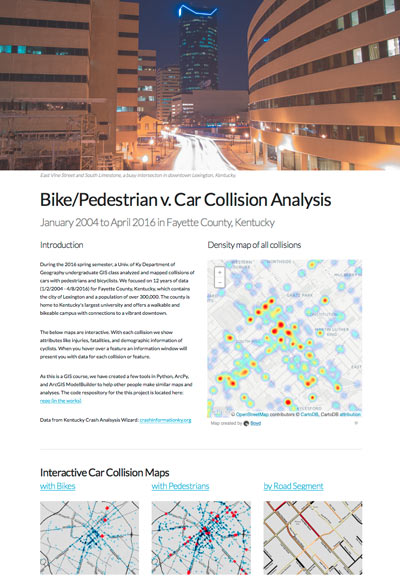
For a GIS course at the University of Kentucky Department of Geography (GEO 409), we mapped and analyzed the incidences of car collisions with pedestrians and bicyclists. Using data from Kentucky Crash Analysis Wizard (crashinformationky.org), we harvested collisions for Fayette County from January 2004 until April 8, 2016, the entire dataset at that point in time.Â
The website of collision maps is available here: http://boydx.github.io/collisions/ and the bike map is http://boydx.github.io/collisions/bikes
Swift Camp Creek Trail interactive 3d map
This interactive 3D map was built in QGIS using a add-on named QGIS2Threejs. The add-on builds the model from digital elevation model in QGIS and drapes the layers symbolized in map view over the model. It utilizes javascript to make interactive in browser.
Explore the Swift Camp Creek Trail in the Red River Gorge with this 3D map. Learn more about this trail in our hiking trail page.
Weather station almost full!
Happy New Year to you! We invite you to our four year anniversary of documenting weather animations in the Great Smokies. When we move into 2016, we’ll cycle out the observations for 2012. Over the past dozen years we’ve documented weather for areas our maps cover. More recently, we’ve offered an online media library of webcam and satellite animations and daily weather summaries for the Great Smoky Mountain National Park. They’re offered as animated GIFs for three webcams and a visual GOES satellite for the region.
In short few hours, we’ll have four complete years of these webcams. If you need a nice sunset or sunrise, feel free to explore the archive.
As we look to the future, we’re excited to investigate the public data that many personal weather stations are feedings services like Weather Underground and Netatmo. We’ll start aggregating weather station data for our hiking areas and offer it here. That’s a goal for 2016!