Historical & 3D Maps of the Great Smokies

Historical MapWe’re continually updating the Great Smoky Mountains National Park Trail Atlas and hope to have a pre-release sample here by early March. The emphasis now is cleaning the labels on the 1:90k map series. These two maps here are sections in the atlas and we appreciate any feedback or comments. Each link takes you to a zoomable and pannable image of the map.

The map on the left is the Pioneer Places of the Great Smoky Mountains, a 1926 U.S Geological Survey map overlaid with modern-day park destinations. The map shows the park on the eve of its creation. The cartography is exceptional and has been preserved where possible. Many of the park place names have changed over the century with the addition of many dedicated names after the park’s creation. In some cases names were moved to accommodate significant persons deemed more worthy of a place name than the existing title.

3D Map of the Great Smokies
The map on the right is a Bird’s Eye View of the Great Smoky Mountains. This 3rd draft 3D map shows the major landforms in Smokies and helps the hiker understand the topography and major drainages in the park. Each feature has an elevation (in feet above sea level) tagged in its label. The Appalachian Trail is signified by the yellow line. This major revision pushes the colors to purer CMYK mixes that make it less muddy in process-color printing.


Waypoints in the Great Smoky Mountains

Manual CoverHiker Great Smoky Mountains GPS Data Pack
Waypoints & track GPX data for trails, trail intersections, backcountry camps, summits, gaps, and many other locations for backcountry navigation.
Download: 36 megabyte
Format: GPX & PDF
Pieces: Map Guide, GPS Manual, Gazetteer, Data
Ownership: Great Smoky Mountains National Park, NPS

Great Smoky Mountains GPS Data Pack: $6

Our data pack contains 16 GPX files, companion gazetteer, and historic topographic map with 1-minute GPS grid. The product is offered only as a 36 megabyte download, which includes all documentation, maps, and data. Buyers have free access to new releases and updates.
[Read more…]

Great Smoky Mountains Weather Station

WeatherWe introduce our new weather page for the Great Smoky Mountains National Park.

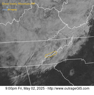
This site aggregates the best weather data and maps for the national park and surrounding mountain area. Maps are from the National Weather Service (NWS) and composited with the national park boundary for easy location. The data is fed from real-time NWS observations and watches, warnings, & advisories.

We think this is the best page for your weather needs if you plan to visit the smokies or long to be there now. For example, the map at left shows the visible satellite of the region centered on the park, shown in the yellow polygon. Cloud cover is good to consider for photographic trips. If the map is dark, well…you’ll need a flash or long exposure.

Other weather information and tidbits we include are links to the official NWS forecast page, which is an excellent site, and webcams for Look Rock and Purchase Knob. We have a link to the high & low temperatures, precipitation, and snow depth for the Sugarland Center, Newfound Gap, Cades Cove, Oconaluftee, & Mt. LeConte.

You can visit the page here: http://www.outrageGIS.com/weather/grsm. We also constructed a page that has current radar, visible satellite, and weather statements here.

Map Atlas of the Great Smoky Mountains

Bird's Eye ViewHiker Hiker The Great Smoky Mountains Trail Atlas
Over the past few months, we’ve been designing this new map/atlas of the Great Smoky Mountains. The atlas will contain 1:96,500 scale full-color maps that show all trails, high points, low points, waterfalls, forest cover, spot elevations, backcountry campsites, and a UTM grid and GEO graticule for use with GPS. A companion booklet and insets will discuss trail statistics, such cumulative elevation gain/loss and start/end points, climate for different elevations, park amenities, and historic structures found along the trails. [Read more…]

0

Your Cart