Ohio River bend at Dayton, Kentucky

Newport levee system

Dayton levee system

Dayton, Kentucky depends on a levee system to prevent flooding by the Ohio River. From this overlook at Eden Park in Cincinnati, Ohio, we can clearly see in the left half of the image how much the city is protected. The inside channel of the meander (the Kentucky side) historically had a much lower slope created by the mechanics of stream flow. As stream flow congested and slowed on the inside channel, sediment dropped from the river that mounded into a point bar and usable land.  However, periodic high river flows would inundate the whole point bar and the challenge became flood management. Dayton’s point bar was secured by this artificial levee system that is only so high. Our engineering of cities depends on knowledge of climate change.

We have created a zoomable photograph that you can use to inspect this levee:

Full-screen view of the photograph.


Eagle Rock and Boulder Canyon views

Eagle Rock climbing area in Boulder City canyon

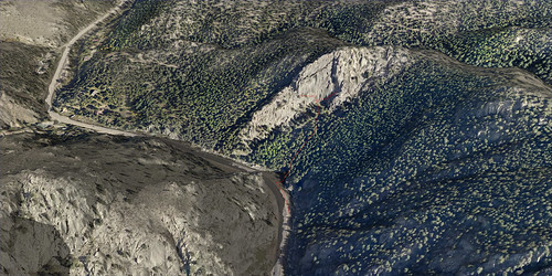
We’ve made a series of 3D views for Wolverine Publishing’s climbing guidebook for Boulder Canyon, Colorado. This image shows Eagle Rock and was made with high-resolution aerial photography and LiDAR elevation data. The data was supplied by Boulder Canyon Climber Community.

Cumberland Gap NHP interactive map

Interactive 3d map using Leaflet

Interactive 3d map using Leaflet

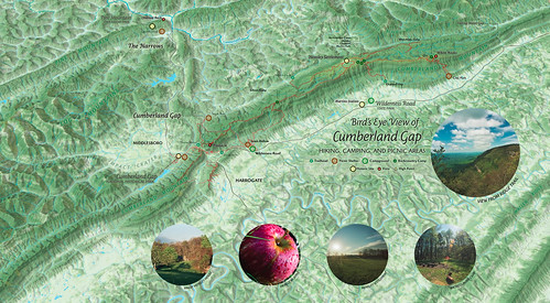
A bird’s eye view map of Cumberland Gap National Historical Park created in conjunction with our 2016 new release of the park map. This map is not georeferenced to real-world coordinates and uses a javascript mapping library, Leaflet, to generate the interactivity. We think of the developing project as a gateway for multimedia about the park’s environment and history that we want to share.

https://outrageGIS.com/gap/3d


Pilot Knob State Nature Preserve student mapping project

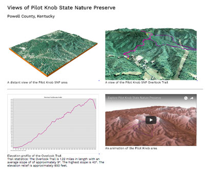
Students in NRE 355 (a GIS calass at the University of Kentucky Natural Resources and Environmental Sciences program) visited the 740-acre Pilot Knob State Nature Preserve on September 21, 2016, and used mobile devices to collect GPS data for the existing trail network. They mapped approximately 3.2 miles of trail then used ArcGIS and CARTO to measure the trails and create a 2D map and 3D visualizations of the nature preserve. Students then created websites to showcase their work.

http://sweb.uky.edu/~blshea1/nre355/pksnp contains maps, animations, and links to student pages.

3D views and animations of Pilot Knob State Nature Preserve

3D views and animations of Pilot Knob State Nature Preserve

Cranksgiving 2017 map

This map is for Cranksgiving 2017, bicycle competition and food raiser for God’s Pantry Food Bank. I put it online this year since the race had about 5x as many grocery stores. Check out the printed manifest and the mobile map: https://outragegis.com/cranksgiving [Read more…]

Chicken Chase map

Map of chicken houses in Lexington, Kentucky

Map of chicken houses in Lexington, Kentucky

Downtown Lexington has a large number of chicken coops. A coop tour has been an annual event for years. In 2016 Floyd’s Farm & Home asked us to make a map of a tour centered on 6th Street. We used the artwork created by Homegrown Press (whose studio is located at 6th and Limestone) and tried to style the map in a similar fashion.

Elevation profile of connected interior spaces

Preview_LexingtonProfile

Enlarge this graphic

It’s downtown Lexington, summer, and hot. Poor air quality and oppressive heat are hazards for older walkers and those with cranky babies. An interior (mostly air conditioned) pedway exists that connects various buildings downtown and is a walking convenience for many folks. When Lexington has more shady pedestrian paths away from city streets, walking inside wouldn’t be so inviting and necessary. [Read more…]

Cumberland Gap trail map at Woodland Art Fair, August 20-21

2016 Cumberland Gap trail map, hiking information

2016 Cumberland Gap trail map and hiking information

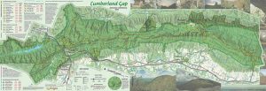
The update to our Cumberland Gap National Historical Park is almost complete. Much like the old map, our 2016 version is a 1 inch to 1/2 mile scale map with 50-foot contours, trail elevation profiles, and  GPS-mapped trails shown in vivid full-color printing. This year we added a layer that shows density of canopy coverage and GPS-mapped Caldwell Gap Trail. The size of the park has increased since our last update, so we’ve included most of the additional land. [Read more…]

East End Preservation Project map

East End Preservation Project map

East End Preservation Project map

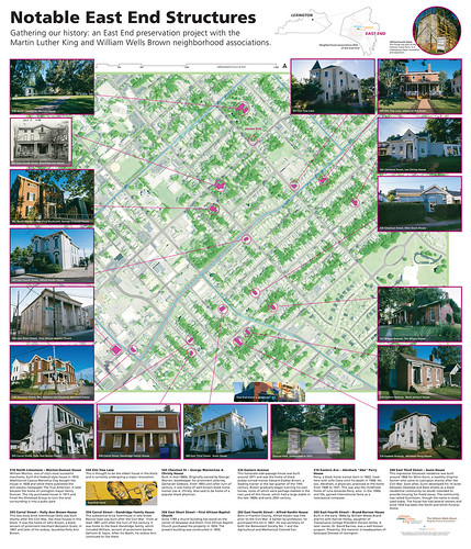
A map historically significant homes and structures in the Martin Luther King and William Wells Brown neighborhood associations; many have connections to African-American work and life over the past two centuries. It was a pleasant afternoon walking Onabits, aka lil’ blue eyes, and taking photographs in my neighborhood. With the growth of the north Limestone corridor and the planned development of the Midland and 3rd street area, it’s important to recognize the history that resonates through downtown Lexington. We’ll come back in 10 years and see how many of these structures remain.

Base map for Salt Lake City hiking

East of Salt Lake City

East of Salt Lake City

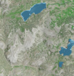
A client needed a base map for an upcoming hiking guide to areas east of Salt Lake City. We came up with a simple, clean photoshop file using NAIP aerial imagery and 1/3 arc-second seamless DEM. The NAIP was used to create an NDVI and estimated canopy cover and the DEM was used as a shaded relief and to generate 40 ft contours. The NDVI and shaded relief were used for emphasis and helped make the aerial ‘pop’ a little more. Lakes and perennial streams were added, but as you can see the don’t register perfectly with the aerial image.

Norris Watershed Trail Map

Norris Watershed Trail Map

Norris Watershed Trail Map

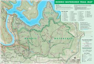
Over the past year, we’ve refined a trail map for the City of Norris, Tennessee. The Norris Watershed Trail Map is probably printed by now and offers GPS mapped trails and mountain biking opportunities. The WPA era dam is pretty cool, too.

[Read more…]

City of Rocks and 3D mapping offer teaching moment

City of Rocks example visual

City of Rocks example visual

With the quality of elevation data increasing, especially with the availability of LiDAR data, we have an opportunity to make unique visuals. Recently Wolverine Publishing needed maps developed for the climbing area, City of Rocks in Idaho. The project needed high-resolution maps and the data was available through public sources. We like making the physiographic base maps for recreation areas and this offered a special challenge. [Read more…]

Lexington Bike/Ped versus Car Collision Analysis

Website of collision maps

Website of collision maps

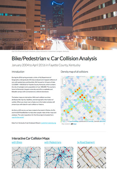
For a GIS course at the University of Kentucky Department of Geography (GEO 409), we mapped and analyzed the incidences of car collisions with pedestrians and bicyclists. Using data from Kentucky Crash Analysis Wizard (crashinformationky.org), we harvested collisions for Fayette County from January 2004 until April 8, 2016, the entire dataset at that point in time. 

The website of collision maps is available here: http://boydx.github.io/collisions/ and the bike map is http://boydx.github.io/collisions/bikes

[Read more…]

Lexington’s Urban Canopy

An exploration of canopy cover measures

An exploration of canopy cover measures

How much tree canopy covers the urban service area of Lexington, Kentucky? Inspired by the Davey Resource Group’s October 2013 study of canopy cover using 2012 NAIP imagery within Lexington’s Urban Service Area, a GIS class at the University of Kentucky created a similar, though limited, evaluation. [Read more…]

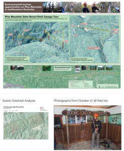
Pine Mountain Canopy Tour

Canopy zipline tour mapping assignment

Canopy zipline tour mapping assignment

What wild weekend and mapping task! Boyd led an undergraduate GIS class at the University of Kentucky and endeavored to map and analyze environmental tourism assets on Pine Mountain. During discussions with Pine Mountain State Resort Park, we discovered a canopy zipline tour, one of the first in the state, was being installed in the park. [Read more…]

0

Your Cart