|
|
videoGIS is a suite of images, resources, and services that allow you to implement the most accurate and attractive map imagery into your post-production workflow. With competitive pricing, exclusive licensing arrangements, and extensive support, videoGIS is your total solution for broadcast map graphics.
The 3 fundamental components of videoGIS are:
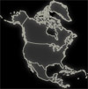
- The core of videoGIS is a series of ultra-high resolution transparent-background images, both in raster and vector formats, that represent various features of geography. These stackable features range from elevation reliefs to populated places to public recreation areas. All data is built from the most recent US Geologic Survey and Census Bureau sources.
- The second major feature of videoGIS is access to range of web-based resources. These resources include updates and additions to the layer library, search utilities for quickly finding features, a user group discussion forum, product support features, and a host of useful graphic design tools.
- The third component of videoGIS is free and reduced-rate custom mapping services. If you need a unique map frame for a special broadcast, or need special map symbols, but don't want to purchase expensive packages, then a subscription to videoGIS is your solution. outrageGIS will use your exact design specifications, such as color schemes, fonts, and logos, to provide you the best possible image.
For a list of available products and graphic design specifics, see our specifics page. For examples, visit our samples page. Email us for a high quality sample and pricing.

NEW!! Send us your feedback and we'll send you a FREE
GIFT
|
|
|